
CNN Indonesia | Saturday, 16/10/2021 23:36
According to PVMBG, the earthquake in Bali was related to active fault activity around the location of the epicenter.
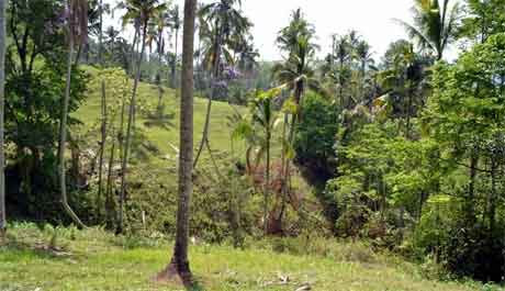
Residents observe the rubble of a worship place damaged by an earthquake in the Besakih area, Karangasem, Bali, Saturday (16/10/2021).
An earthquake with a magnitude of 4.8 on the Richter Scale occurred on land at a distance of eight kilometers northwest of Karangasem with a depth of 10 km on Saturday (16/10) at 04.18 WITA. (BETWEEN PHOTOS/FIKRI YUSUF)
Jakarta, CNN Indonesia --
The Center for Volcanology and Geological ( Hazard Mitigation PVMBG ) of the Geological Agency of the Ministry of Energy and Mineral Resources explained that the cause of the earthquake in Karangasem Regency, Bali on Saturday (16/10) was related to active faults around the location.
Based on information from the BMKG, the earthquake occurred at 03.18 WIB. The epicenter of the earthquake was located on land at coordinates 8.32° South Latitude and 115.45° East Longitude with a magnitude of 4.8 at a depth of 10 km.
The location of the earthquake was about 8 km northwest of Karangasem Regency.
See Also:
Alert for Aftershocks in Bali, Bangli Residents Begin to Evacuate
"Based on the location of the epicenter and depth, the earthquake event is associated with active fault activity around the epicenter of the earthquake," said Head of PVMBG Andriani in a written statement, Saturday (16/10).
Citing information from the BMKG, the earthquake shocks in Karangasem were felt in Denpasar, North Lombok, East Lombok, West Lombok, Central Lombok, and Mataram.
Shocks around the location of the epicenter are estimated at the V MMI (Modified Mercalli Intensity) intensity scale.
According to data from the Geological Agency, Karangasem and Bangli districts are located in high to medium earthquake-prone areas (KRB).
Meanwhile, based on the Geological Agency's soil movement vulnerability zone, the Bangli area is mostly included in the medium soil movement vulnerability zone, which means that in this area there is ground movement in areas bordering river valleys, escarpments, and road cliffs, or if the slopes are disturbed.
This earthquake caused damage to a number of houses and casualties were buried by landslides in Karangasem Regency. In Bangli Regency, Trunyan Village, two people died as a result of the earthquake and four people were buried under collapsed houses but were able to be saved.
See Also:
M 4.8 Earthquake in Bali: Damaged Buildings, Residents Scattered
Andriani said the earthquake resulted in collateral hazard in the form of soil cracks, landslides, and rock debris.
"Residents should be alert if there is a crack in the ground on the top of the hill that is circular in shape towards the valley, because it can trigger ground movement triggered by strong earthquake shocks and high rainfall," he said.
(hyg / fea)
Baca artikel CNN Indonesia "PVMBG Jelaskan Penyebab Gempa di Bali" selengkapnya di sini: https://www.cnnindonesia.com/nasional/20211016231417-20-708747/pvmbg-jelaskan-penyebab-gempa-di-bali.
Download Apps CNN Indonesia sekarang https://app.cnnindonesia.com/


No comments:
Post a Comment